Sale Price:
£9.99
Original Price:
£16.95
Covering an area of 117 square miles and containing over 120 miles of navigable waterways, The Broads National Park is a network of interconnecting rivers and lakes (known as Broads) that form one of the most important wetland habitats in Europe. There are a total of seven rivers and 63 broads, most of which can be explored by boat or on foot revealing hidden tranquil spots that are perfect for relaxing. This comprehensive guidebook consists of 21 chapters, each referring to a village or town where mooring and/or parking is available in the Southern Broads, which is anything south of Great Yarmouth. Within its pages are maps and details of local shops, pubs, restaurants and services, as well as over 40 walks that explore the stunning wetland landscape. Chapters included are: Barnby, Beccles, BerneyArms, Bramerton, Brundall, Bungay, Burgh Castle, Burgh St Peter, Cantley, Claxton, Geldeston, Langley, Loddon, Norwich, Oulton Broad, Postwick, Reedham, Rockland St Mary, Somerleyton, St Olaves and Surlingham. Walks range from between 1 and 8 miles with some requiring the use of public transport to return to the parking area or mooring and others creating a circular route. Maps included are sourced from OS OpenData and provide a good general idea of the landscape but it is recommended an up to date OS Explorer Map is used alongside for easier navigation. Looking to explore the Southern Broads by boat, canoe, kayak or on foot? Then this is the companion book for you! Look out for the guide to the Northern Broads and also the Complete Broads National Park Guide!
Customer Rating: 4.0/5
Paperback | Page Count: 180
 Image 1 of 6
 Image 2 of 6
 Image 3 of 6
 Image 4 of 6
 Image 5 of 6
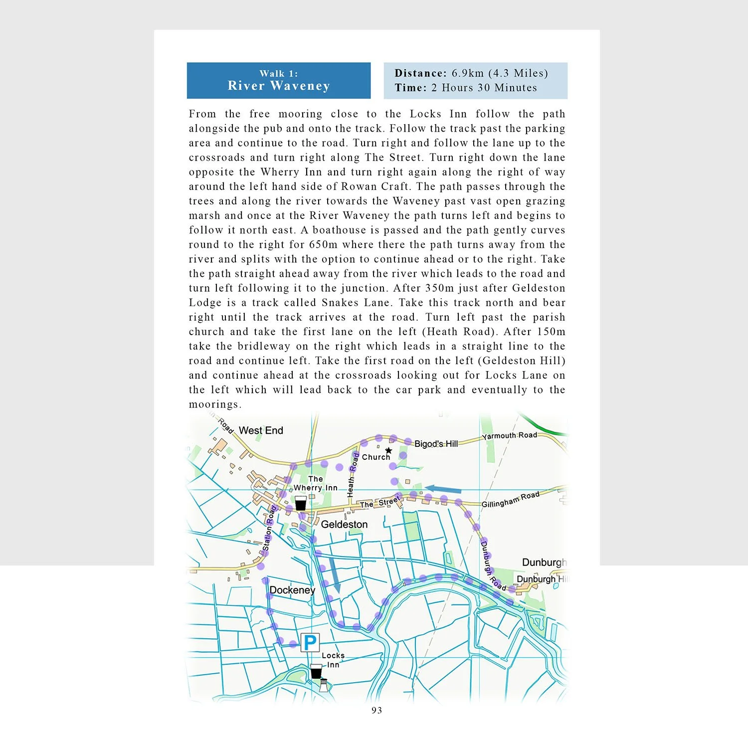 Image 6 of 6